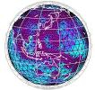
Developing imaging and modeling techniques for the scanning of the Earth’s interior from the upper layers to greatest depths
Geoazur’s activities cover the major imaging techniques allowing the scanning of the Earth from the greatest depths (travel time tomography and tomographic full waveform inversion) to the lithosphere, and up to the outermost shell, the crust (tomographic full waveform inversion), as well as the major seismogenic faults that affect the lithosphere in active and passive seismic marine zones.
Geoazur is one of the leading worldwide players in developing a tomography technique based on full waveform inversion (FWI).
Geoazur has developed an original stock of instruments devoted to the lithosphere auscultation in the marine environment, which include Ocean Bottom Seismometers (OBS), a MUltiparameter Geophysical Ocean Bottom System (MUGOBS) for long-term monitoring of earthquakes and environmental parameters, and Mobile Earthquake Recorders in Marine Areas by Independent Divers (MERMAID) able to move around in inaccessible ocean areas.


